Participants will need a smartphone, access to a computer that connects to the internet, and a Gmail address. If you don’t want to use your personal email address, you are encouraged to create a new account for this study. This Informed Consent Statement includes details of the procedures for the study.

1. If you are eligible to participate, you will be asked to take a brief demographic survey. The questions on this survey will ask about your gender, age, marital status, household makeup, education level, employment status, income, disability status, and preferred mode of transportation. This will take 1-3 minutes to complete.
2. Eligible participants will be asked to install two apps on their smartphone and log in to both with their study Gmail account. The first is Google Maps (iPhone, Android), and the second is PACO, Personal Analytics COmpanion (iPhone, Android).
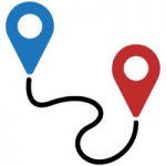
3. Enabling Google Maps location history will begin tracking your location and create a Timeline of your travel history. This will show which modes of transportation you use and the places you visit. This information is private, and only viewable by you, but if you choose to participate in the study, you’ll be asked to verify the accuracy of the data, download files for individual days from your timeline, and upload them to this website (details here).
4. Once your participation is confirmed, you’ll receive an invitation for an experiment on the PACO app which will send alerts to you at different times of the day, or once a day, depending on what frequency you choose. You can change the schedule of the survey to fit your normal habits.
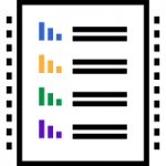
5. Participants can take part in the study as often as they like and can leave the study at any time. Benefits of higher participation include monthly reports about your personal mobility (how many miles you traveled, how many hours you spent using different modes of transportation, plus insights into your moods at different times of day, with companions, or on different transportation modes, and a visualization of your travel), plus you’ll be contributing to knowledge about our relative mobility!
Here are a few helpful links if you are eligible and choose to participate:
Getting Started
Working with Google Maps Timeline
Tips for Participants